
A Vision to Replace the West Seattle Bridge
Presented by Wittman Estes for the Seattle Design Festival 2020
We all need to cross the Duwamish River.
Why not create connections that combat climate change?
What.
The West Seattle Bridge has failed. After only 36 years of useful life—it will be closed until 2022, and probably forever. Completed in 1984, the concrete high-rise bridge over the Duwamish River suffered from a lack of vision. The singular and rigid crossing was designed only for auto traffic and excluded pedestrians, bicycles, mass transit, and other life.
Why.
Climate change and Seattle’s identity as a global leader in green infrastructure demand that we build a long term living future. We need a resilient replacement for the bridge to cross the river—by car, bike, and foot—that supports the livelihoods and ambitions of the communities and neighborhoods within the highly industrial Duwamish Valley.
Duwamish Crossings is a on-going platform to promote this network of design ideas, mapping, studies, and news about a feasible ecological alternative for the West Seattle Bridge. The following exhibition presents -
Our investigations of the Duwamish Valley past and present through the lens of infrastructure, nature, and communities
Our vision of the future - a series of multi-modal connectors that cater to various modes and distances in and around the valley.
Urban walking routes that take you along the river, past and present, and encourage you to imagine how to better connect with and cross the river.
To view our work in person, we are proud to be a part of this year’s Annual Model Exhibit, hosted by the Seattle Architecture Foundation at the Center of Architecture and Design. To make an appointment for the gallery viewing, please visit here

PAST + PRESENT
While Duwamish Crossings is a speculative project, we first want to acknowledge that we are on the traditional land of the first people of Seattle, the Duwamish people past and present, and honor with gratitude the land itself and the Duwamish Tribe.*
From time immemorial, the Duwamish Valley was home to several villages of the Duwamish Tribe. The river was a meandering provider of fish and shellfish, surrounded by marshlands and tide flats. Longhouses lined the river. After the European settlers arrived at Elliott Bay in the 1850s, the Duwamish people, along with neighboring tribes, signed the Treaty on Elliott Bay, exchanging their land for hunting and fishing rights and reservations.**
In 1895, a plan was outlined to straighten the Duwamish River to increase industrial development in the valley and control floods. The valley quickly became an industrial hub and consequently was declared a Superfund site by the United States Environmental Protection Agency in 2001.
Now in 2020, we are in the midst of the COVID pandemic and the West Seattle Bridge is closed. What’s next for the Duwamish River?
*For more information about land acknowledgement, please visit here
**The treaty has yet to be honored.

1904: A railroad trestle connecting to West Seattle and going over tideflats, which will eventually be filled in to become Harbor Island (MOHAI)

Early 1900's, the Duwamish River being dredged and straightened (the Burke Museum)
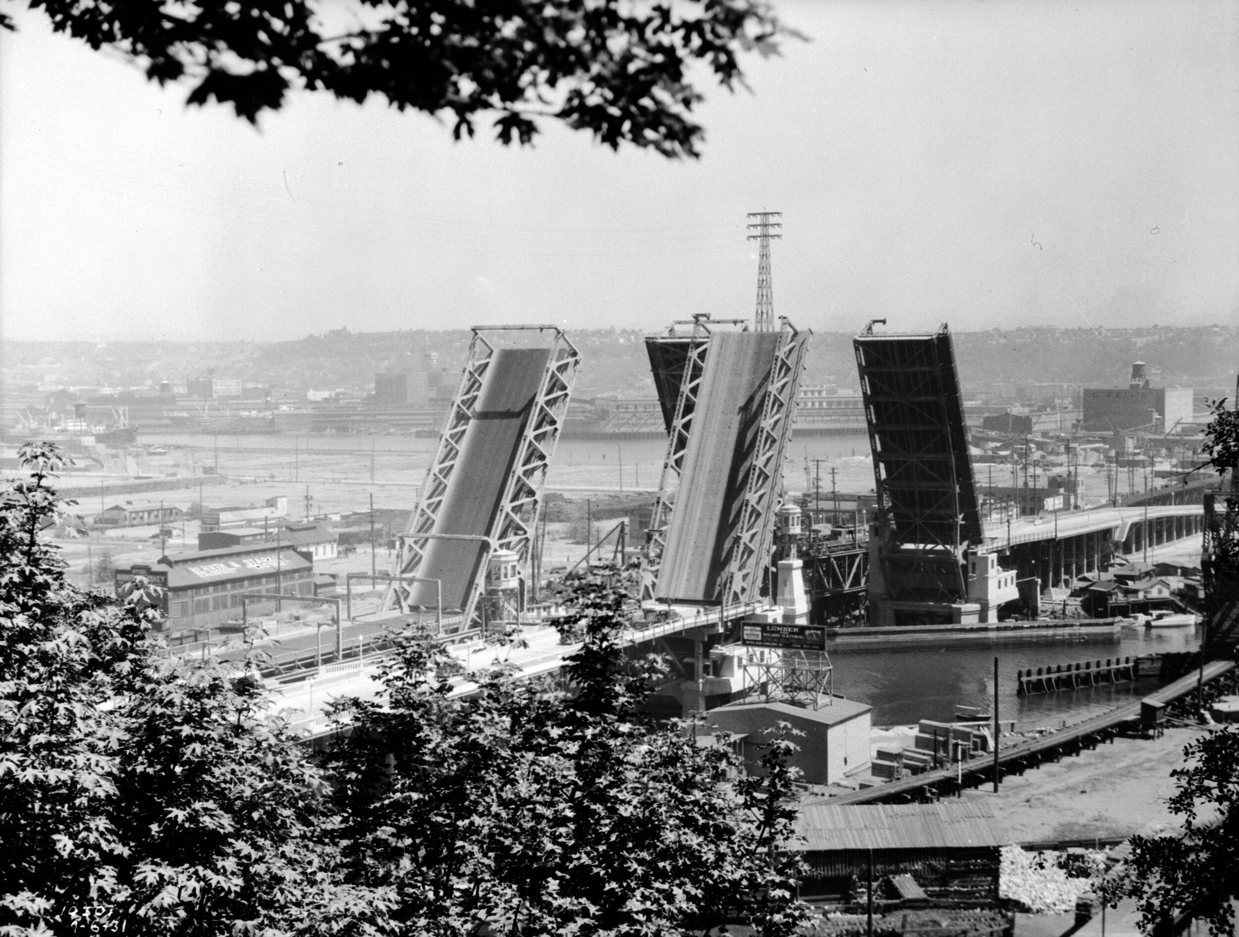
Built in 1924, the Spokane Street drawbridge. In 1978, a freighter ship crashed into the drawbridge, causing a 6 year closure. (Seattle Municipal Archives)
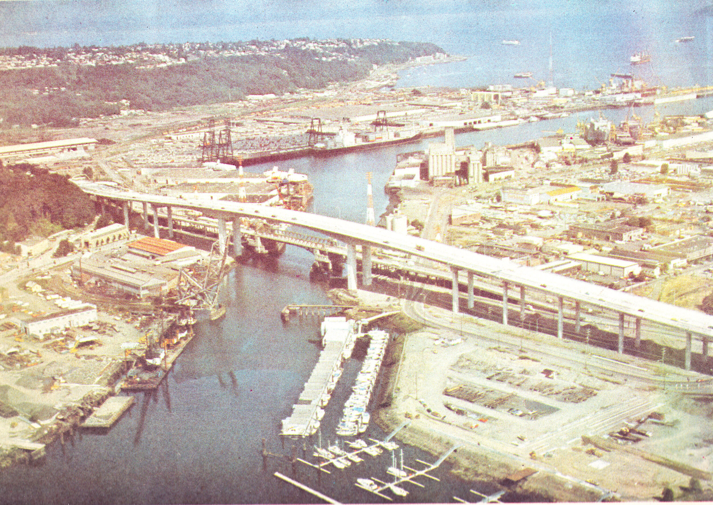
1984, the current West Seattle Bridge was opened (Seattle Municipal Archives)
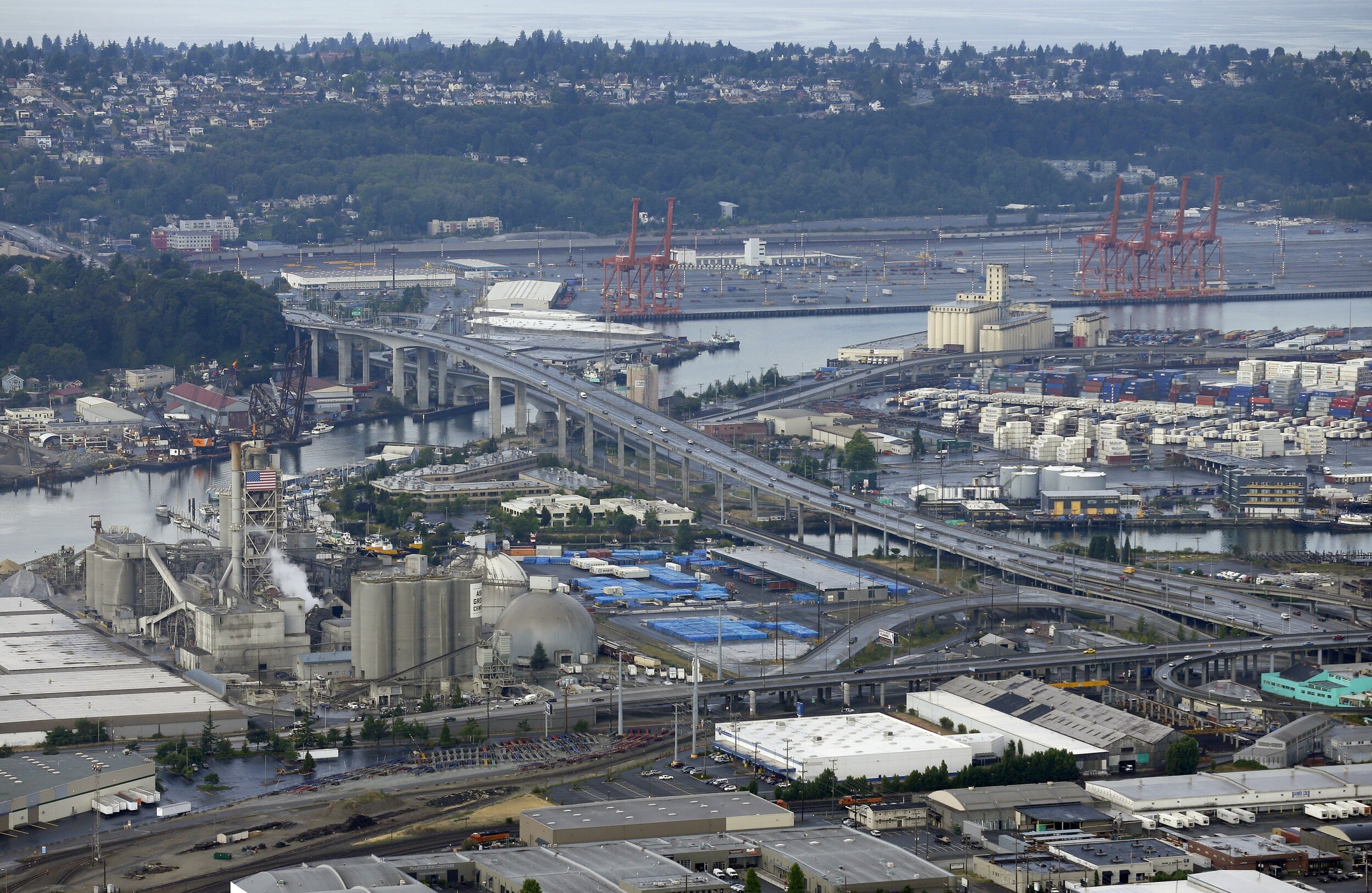
The West Seattle Bridge now (KIRO)
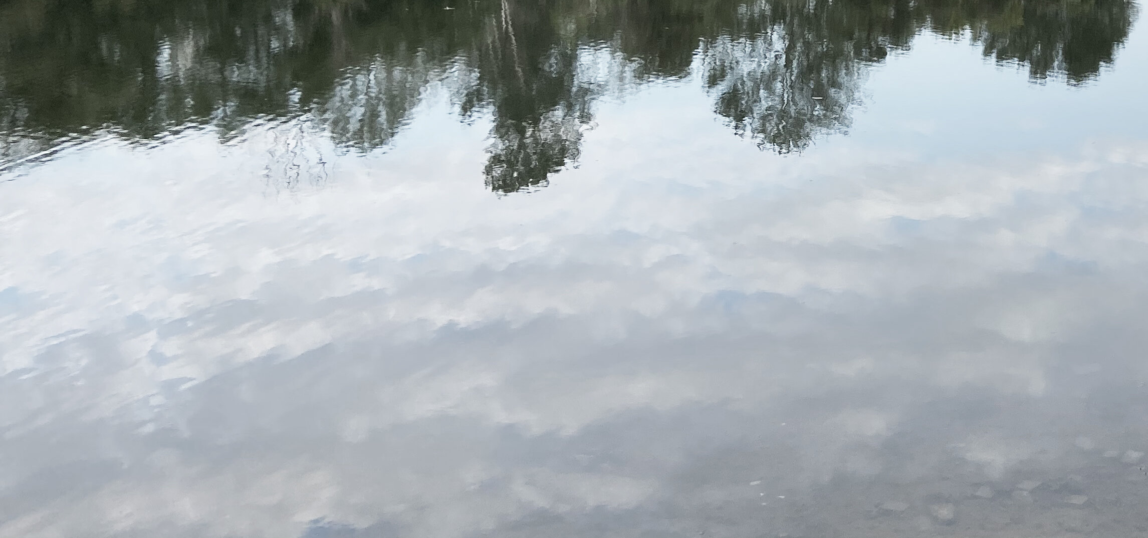
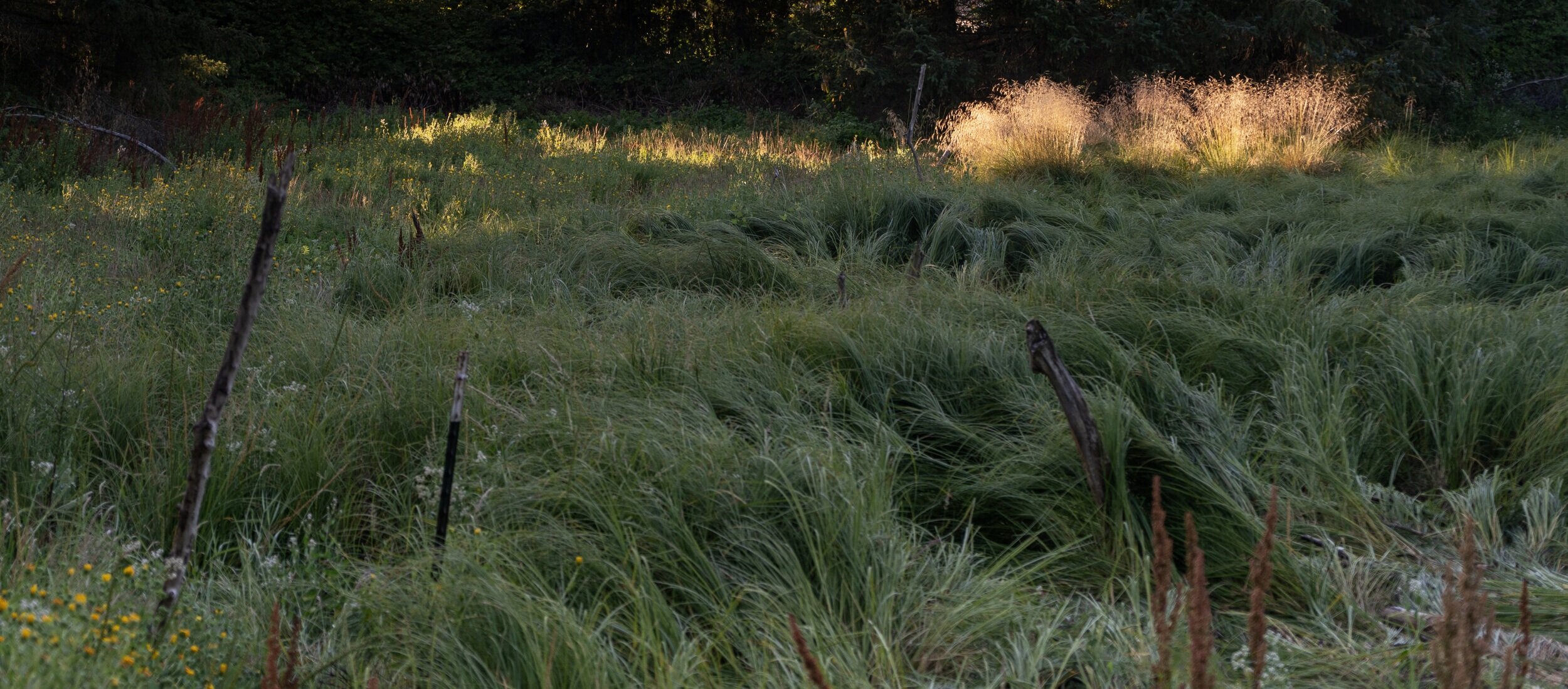
The Duwamish River Now: photo series by Kirk Hostetter
The West Seattle Bridge seen from Terminal 18 Park

Herring's House Park
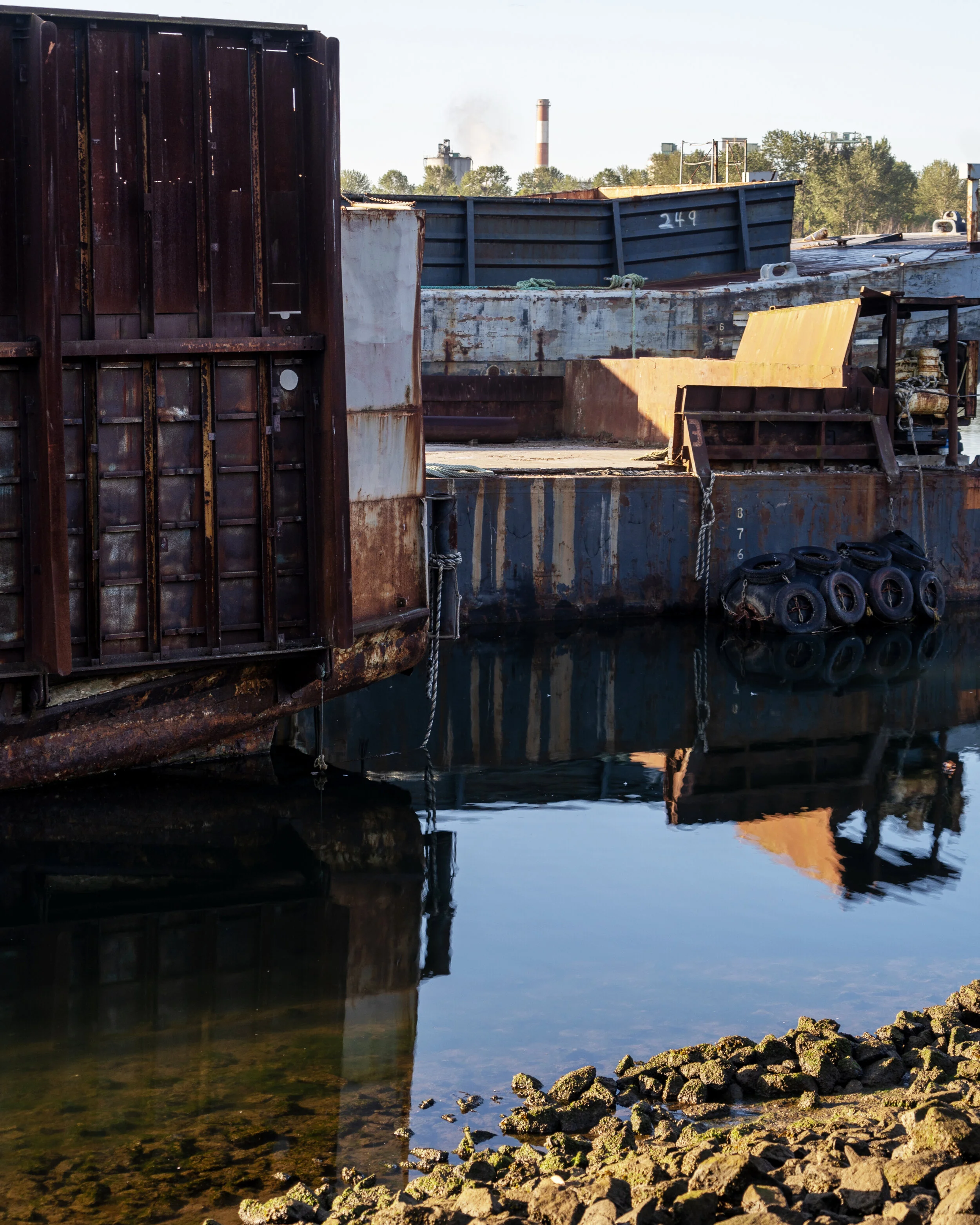
Industrial storage seen from Herring's House Park
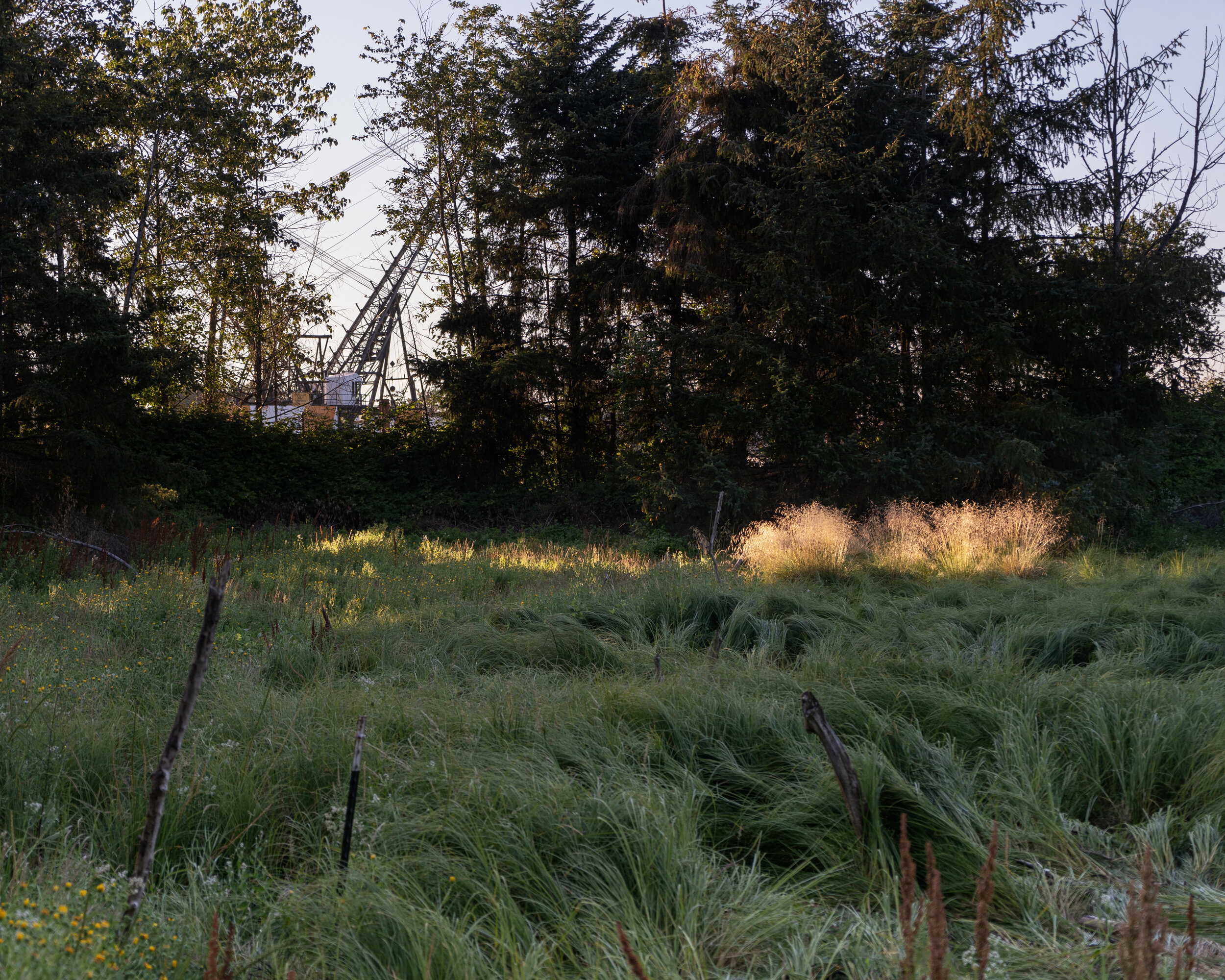
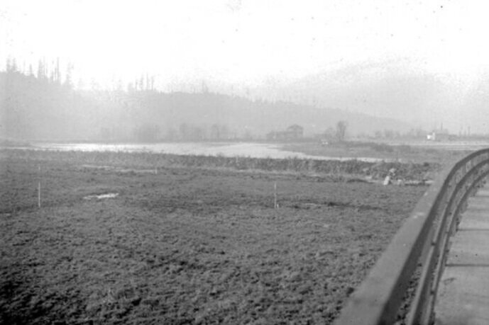
Grass field at Terminal 107 Park

Terminal 108/Diagonal Park

View of the West Seattle Bridge from Diagonal Park

Infrastructure at Terminal 108/Diagonal Park

South Park Bridge

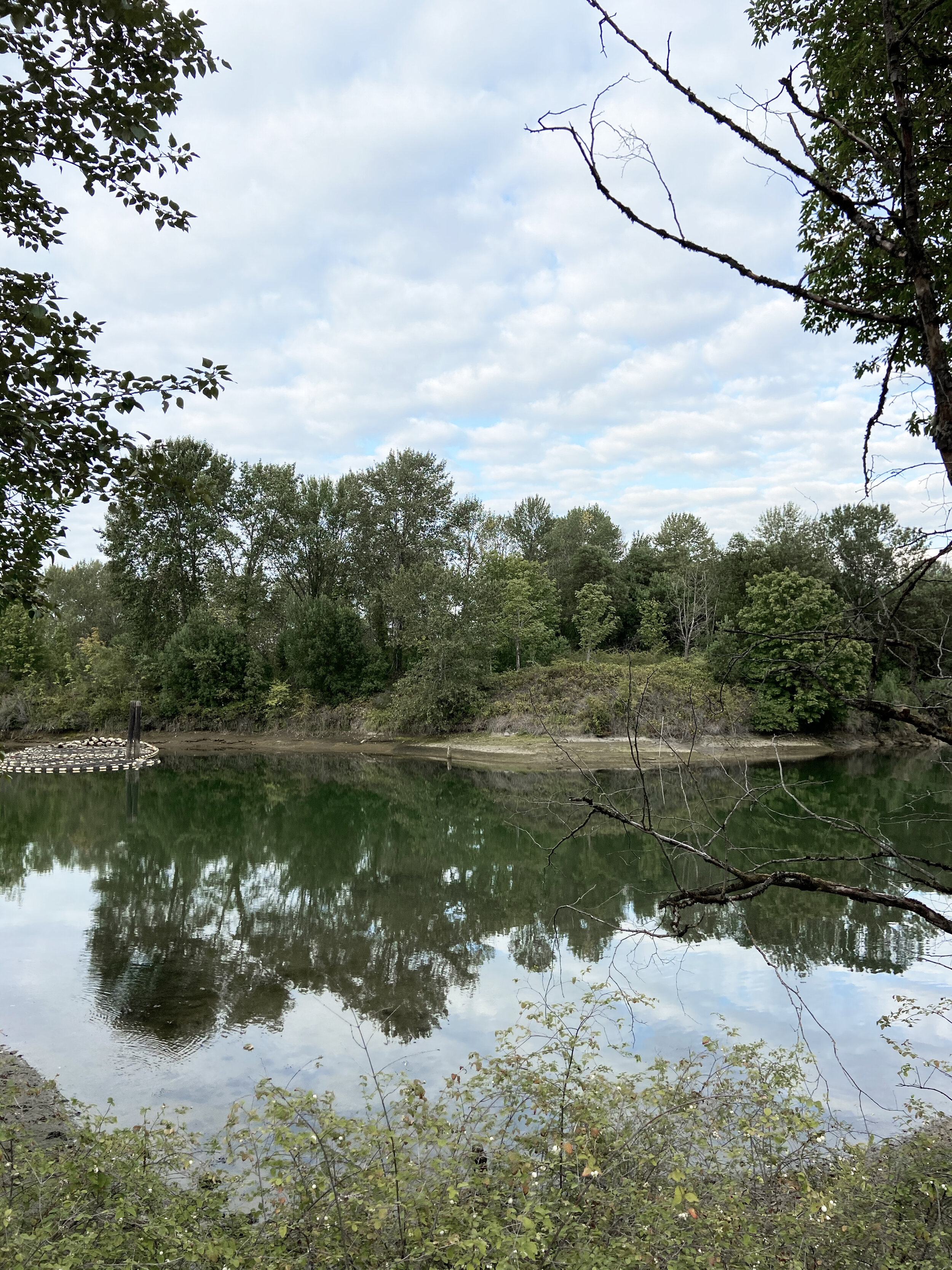
River access at Duwamish Waterway Park
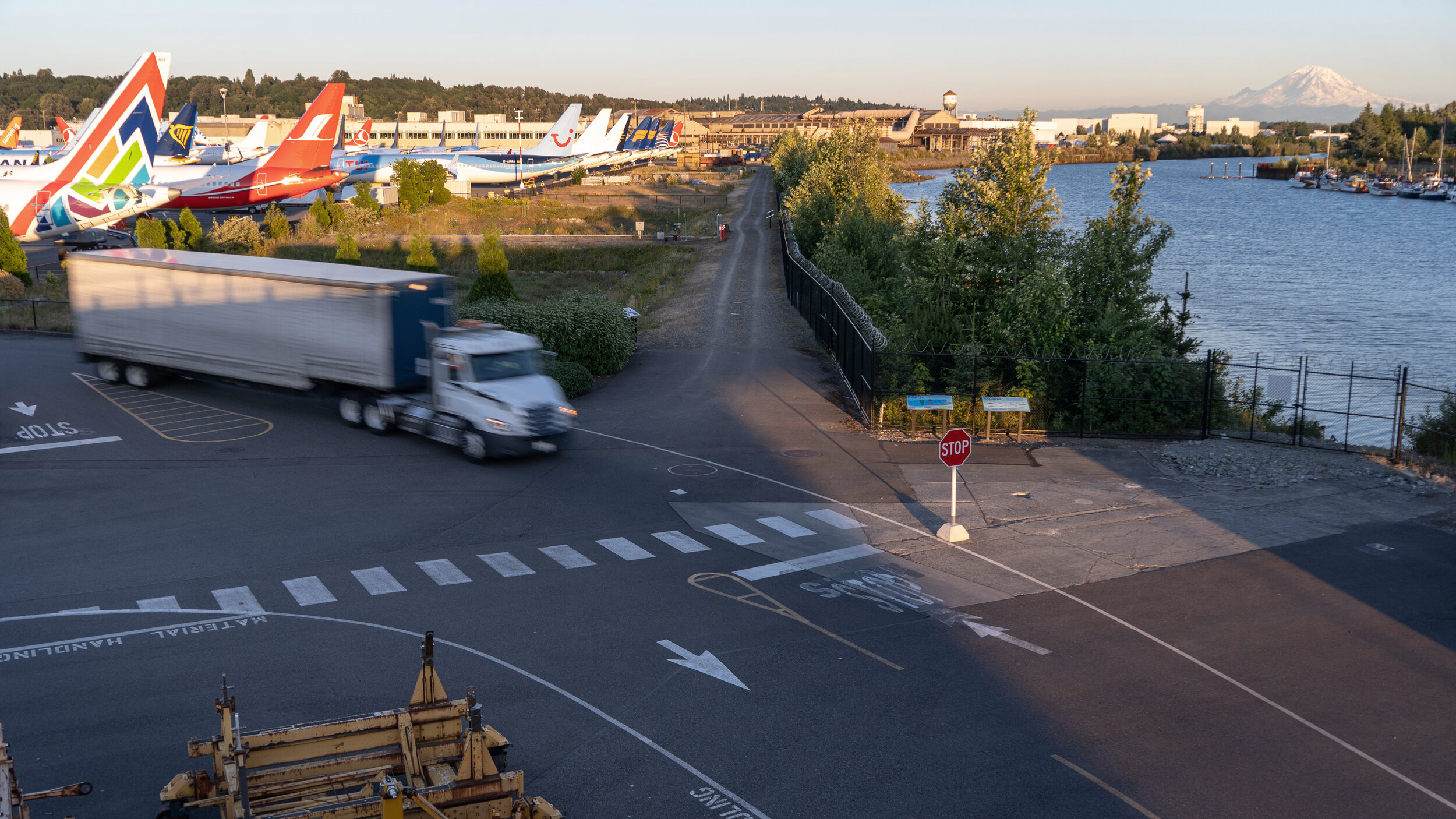
View of Boeing Field and Mt Rainier from the South Park Bridge

historical and existing natural areas

existing modes of transporation

existing neighborhoods & key communal areas
The above maps examine the historical/existing conditions and key areas in the Duwamish Valley.
Notably, how the area was shaped by the original form of the Duwamish River and how it is connected and used now.
our vision: bring nature back to the river
The closure of the West Seattle Bridge amplified the lack of connections we have across the river and with the river. It transferred more noise and air pollution to the South Park and Georgetown communities that were already battling inequities and challenges of being encompassed by industrial zones. Its timely closure in the midst of a global pandemic questions our dependency on cars and contributes to our growing urgency to combat climate change.
Our proposal is twofold -
Return a part of the river back to its original shape and restore its surrounding areas back to park and nature reserves
Provide three multi-modal crossings that better connect travelers to the river or their destinations by car, bike, and foot.
West Seattle Connector (Urban Air Filter): A new Columbian Way/West Seattle Bridge crossing that reconnects East Duwamish and West Duwamish Greenbelts.
Oxbow Crossing: A new crossing connecting the two sides of the river from East Marginal Way on the east to near the regionally-significant historical sites Duwamish Longhouse and Herring’s House Park on the west.
Georgetown Crossing: A new crossing at the 1st Avenue South over to Highland Park Way.
PAST: Early 1900s (Seattle Municipal Archives)

PRESENT: 2020 (Kirk Hostetter)
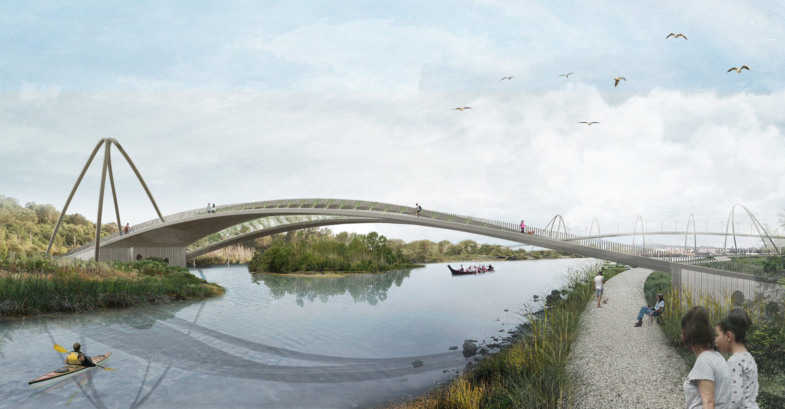
FUTURE! View looking at the proposed Oxbow Crossing with the West Seattle Connector (Urban Air Filter) beyond
People on foot, bicycles, and non-human animals can cross the river via 3 new ecological connectors. Steel frame bridges spring from inhabitable bases and weave together multiple lanes of movement that connect with the river and surrounding nature.
ABOUT TIME
Get to know the past, present and future of the Duwamish River through Urban Hikes that link together parks, bridges, and points of historical and future interest. Imagine how the industrialized and dredged course of the River can be re-imagined as an alternative future with ecological crossings and newly restored marshlands and waterfront. Visualize the river returned to it's natural course with multi-modal pathways for people and nature.
South Park - Georgetown Route
Follow the river from Duwamish Waterway Park, cross the South Park Bridge and walk to the Duwamish River Public Viewpoint. Continue along East Marginal Way and walk along the residential/industrial edge on Ellis Ave S. Head west towards Corson Ave Sand make a loop following the pre-dredging course of the Duwamish Oxbow along South River Street, Corson Ave, and South Fidalgo Street. Note how the streets of Georgetown were formed from the natural course of the river waterfront. Complete the loop at Oxbow park, the site of the proposed new Georgetown Crossing ecological connector.
pdf link
Duwamish Longhouse & West Seattle Bridge Route
Follow the river from the Duwamish Trail to Terminal 107 Park and Herring’s House Park. See the Duwamish Longhouse and Cultural Center, along West Marginal Way and head to Terminal 105 Park. Turn on SW Marginal Pl and turn east onto the West Seattle Bridge Trail. Take the stairs down to Terminal 18 Park. Back on the West Seattle Bridge Trail, head to the West Seattle Bridge Trail Fishing Dock. Complete the loop at Terminal 108 Park, the site of the proposed new Oxbow Crossing ecological connector.
For the adventurous, connect to Beacon Hill along the S Spokane St. Take the stairs up to the Spokane St Viaduct and stairs back down into Beacon Hill.
pdf link
Duwamish Crossings team
Matt Wittman
Angela Yang
Canan Sevim
Contributers
Julia Frost
Kirk Hostetter
About Wittman Estes
Wittman Estes is an award-winning interdisciplinary collaboration led by architect Matt Wittman and landscape designer Jody Estes, and founded on the idea that buildings and landscapes could be combined into one interconnected whole. Based in Seattle’s Georgetown neighborhood, the office is known for innovative designs, energy-positive prefab housing, multifamily housing, and for their ability to design for sensitive ecological sites. The firm has been published in Dwell, Dezeen, Gardenista, Luxe, and Sunset among other media. Their design work has been featured in exhibitions in Seattle and San Francisco, as well as has been recognized at the AIA Seattle Honor Awards.